
The stark drama of the Badlands landscape is undeniable. Cutting across the plains of South Dakota, the Badlands Wall rises above the lower prairie, a rippling series of ridges and gullies.
This alien landscape separates the upper prairie from the lower prairie and while it may appear nightmarish, it is a photographer’s dreamland for stark and unique landscapes. I’m going to give you some background information on how this place came to be, and then I’ll give you the juicy bits on where to go when you get inside.
An up-close look at the badlands is worth your while. In dinosaur times, a large shallow sea covered these Great Plains and left behind an enormous amount of ancient ocean fossils. Over time, and by time I mean millions of years, this shallow sea turned into a jungle, which in turn left behind even more fossils and has made this the largest known grouping of mammalian fossils in the world. Think three-toed horses, rhinos, beavers, and camels from 30 million years ago. Makes you feel a bit insignificant…
As far as those crazy looking spires and gulches that scream “BADLANDS” – you can thank the simple geological processes of deposition and erosion.
Deposition is how we get sedimentary layered rock with those characteristic colored bands you see in these images. The colors come from different periods of time in which the land was in different forms. The oldest rock – the Pierre shale – is from the shallow dinosaur sea. When the Rocky Mountains and the Black Hills popped up, the sea drained away and the upper layers weathered into a yellow soil and give us some very interesting yellow stripes visible at certain areas of the park. Above that we have a grey rock deposited by rivers in a subtropical floodplain, tan rock from a savannah, and a light colored top rock layer created by windblown volcanic ash as the area became drier and cooler.
When the nearby Black Hills rose half million years ago, streams and rivers stopped depositing sediments and instead became forces of erosion. The Badlands erode as 1 inch every year, and as much as 3 inches in some place. At that rate, they’ll be gone in another half million years.
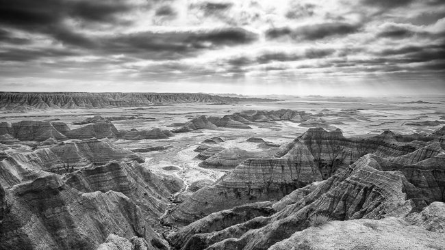
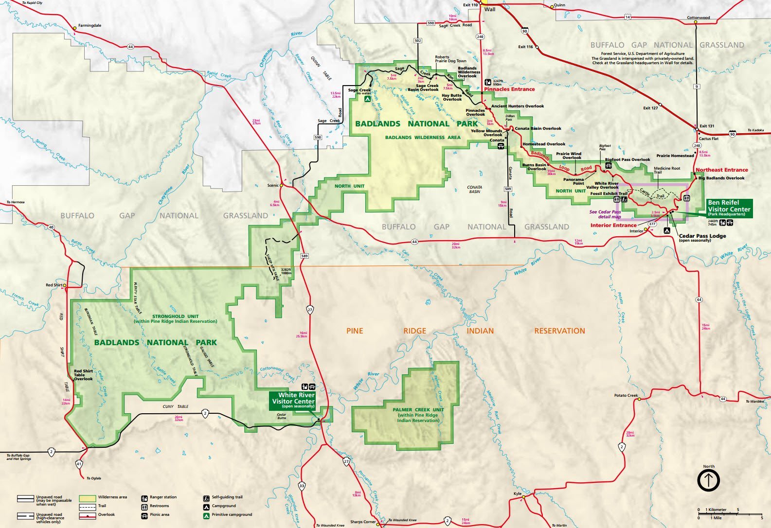
Enough about science – let’s talk about the here and now. I’ll tell you right now your best views of the geological formations are going to be when you enter the park, assuming you are coming from the Northeast. The first image on this page was taken from the Big Badlands Overlook. Let’s orient ourselves with a map, shall we?
Now that we are oriented, know this. Your most fantastical mesmerizing badlands-esque rock formations will be over in the Northeast area around Cedar Pass Lodge. This area is going to get you up close and personal with the rock formations and will also allow your to see sweeping vistas of The Wall. In the Cedar Pass area you will find mostly short (and a couple long) trails that will get you into the rock formations. Here is a close up map of that area.
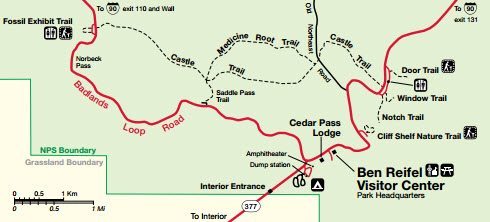
The Door Window, Notch, and Castle trails all share the same parking area, which has a bathroom as well. The Door trail and Window trail are 5 minute strolls, and the Notch trail will take closer to 25 minutes each way. The Notch trail is by far my favorite – you will snake your way into the sedimented spires and lose sight of the parking area. Eventually you will come to a ladder apparatus built into the side of the rock that will quickly give you some elevation for better view. The trail ends at a “notch” cutout of the rock that looks out over the lower prairie. Castle trail is the longer trail, which I did not have a chance to explore. I would say if you’ve got the time, why not?
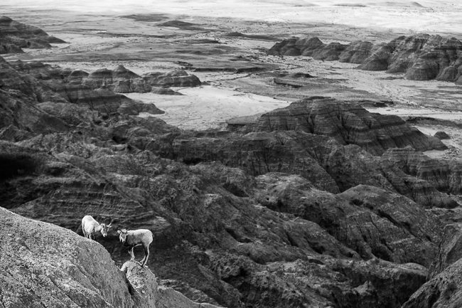
When you’ve had your fill of these spots, hop back in your vehicle, or on your bike if you should be so lucky, and keep moving along Badlands Loop Road. The area is fairly self-explanatory – you will find several overlooks, often with handy educational placards. Eventually you will reach a fork in the road and will ask yourself – should I take the Sage Creek Rim Road? or should I head back up to I-90? If you are interested in seeing the wildlife – namely buffalo and bighorn sheep – and you have a couple hours to spare, I would recommend taking your time driving along Sage Creek Rim Road. This dirt road seems to be where most of the buffalo hangout, and if you’re lucky you might even catch some bighorn sheep butting heads. For how large the are, the buffalo sure are skittish…
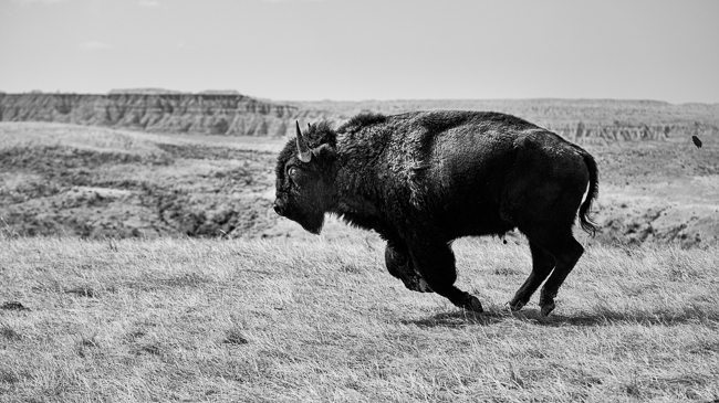
A buffalo running
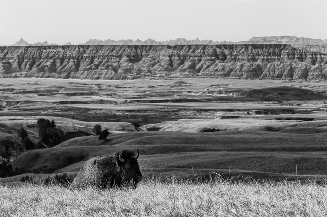
A buffalo sitting
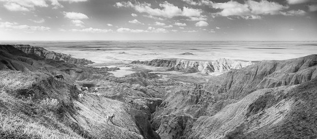
The view from Sage Creek Rim Road
If you are looking to take great photos at Badlands National Park, make sure to bring your polarizer, a wide lens for all those rock formations, and a telephoto lens if you are interested in close-ups of the wildlife. Even more importantly, wake up early and try to time your visit with interesting weather. Remember – a storm will eventually end, and you will then be graced with incredible light and dramatic skies. Be patient, and have fun!
Final Note: Here is a video coming down into the plains inside Badlands National Park…
Leave a reply